|
For a Google Earth file of Upper Mystic Lake in Winchester, MA (USA)
with some buoys marked, click 2011
Upper Mystic Lake Buoys. If your browser does not open the file, save
it on your desktop and open it in Google Earth.
|
Drawing Swim Courses
Using Google Earth
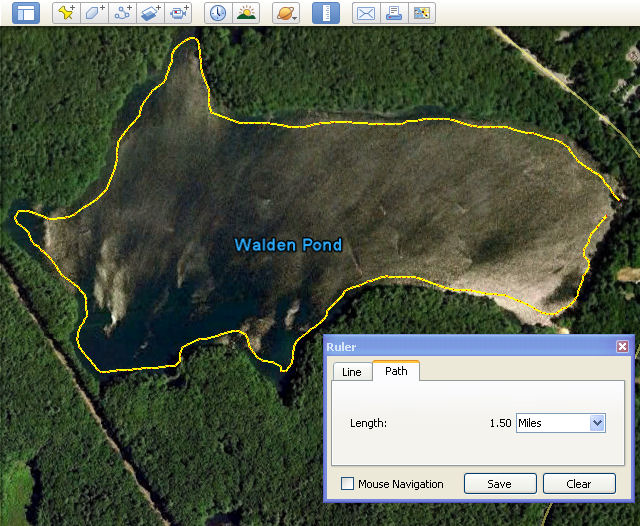
Google Earth is a great tool to use for drawing and measuring swim courses.
Just find your favorite swimming hole in the Google Earth window and use
the Ruler tool to measure a swim path of the appropriate length, as follows:
In the Google Earth window, click the Ruler tool:

In the Ruler box (illustrated to the left), select the Path tab and then
choose the unit of measure for the course length (Meters, Yards, or Miles
usually, but maybe Smoots for the MIT folks).
Then click the mouse pointer to mark each turn on your course. You can
drag the path points later to change the course length.
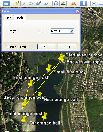
Note: Landmarks tend to stay put, but buoys tend to move or get moved,
and often they are not visible from Google Earth. I've marked some buoy
locations in the lake to the left using a GPS, and then imported the buoy
locations as "Placemarks" in Google Earth. For instructions
on marking locations of buoys (and other things) via GPS, see the documentation
for your GPS unit.
If you swim along the shore rather than crossing open water from point
to point or buoy to buoy, just hold down the mouse button and draw a course
parallel to the shore, as illustrated below.
|