|
| Athletes | Swimming Workouts | Track Workouts | Breakwater Sports Home |
|
Disclaimer: The orange buoys are placed in the lake by the sailing club, and they are moved from time to time. The positions on this map were determined using a Garmin GPS on June 13, 2011. |
Open Water Swimming at
|
|
To measure a course using Google Earth: If your browser supports Google Earth files, click the image to the left to open a map containing buoy markers in Google Earth. Otherwise, right click on the image and save the file on your desktop, and then open that file in Google Earth. In the Google Earth window, click the Ruler tool:
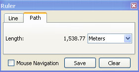
In the Ruler box, select the Path tab and then choose you unit of measure for the course (probably Meters, Yards, or Miles - maybe Smoots for the MIT folks):
Then click the mouse pointer to mark each point along a course of the appropriate length. You can drag the path points later to change your course length. For example, an approximate 1500m (Olympic-distance) course can be a simple loop around the first two orange posts:
|
Copyright © 2011 Breakwater Sports